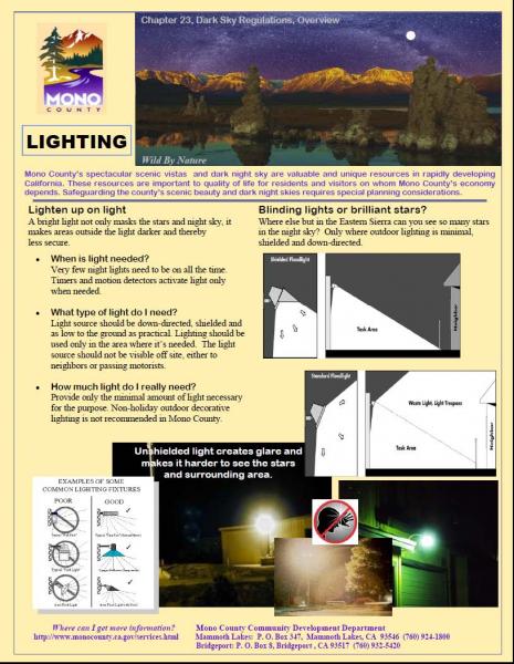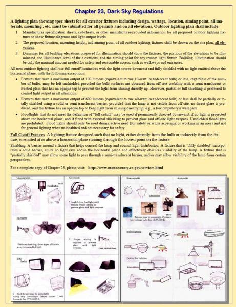


Government Code § 65300 requires each county to "adopt a comprehensive long-term general plan for the physical development of the county." Mono County is unique in that the General Plan and Zoning Code have been combined into one document.
The purpose of the Mono County General Plan is to establish policies to guide decisions on future growth, development, and conservation of natural resources in the unincorporated area of the county. The plan reflects community-based planning and includes individual area plans for Mono County communities.
The following summarizes the vision of the Mono County General Plan:
The environmental and economic integrity of Mono County shall be maintained and enhanced through orderly growth, minimizing land use conflicts, supporting local tourist and agricultural based economies, and protecting the scenic, recreational, cultural, and natural resources of the area. The small-town atmosphere, rural- residential character and associated quality of life will be sustained consistent with community plans. Mono County will collaborate with applicable federal, state and local entities in pursuing this vision through citizen-based planning and efficient, coordinated permit processing.
The planning areas of June Lake and Mono Basin also have separately published area or community plans, which are incorporated into the Land Use Element of the General Plan. These documents will be posted below when they are available.
The work upon which this publication is based was funded in part through a grant awarded by the California Strategic Growth Council. Disclaimer: The statements and conclusions of this report are those of Mono County and not necessarily those of the California Strategic Growth Council or of the California Department of Conservation, or its employees. The California Strategic Growth Council and the California Department of Conservation make no warranties, express or implied, and assume no liability for the information contained in the succeeding text.
Links
[1] http://monomammoth.maps.arcgis.com/apps/Viewer/index.html?appid=8670c63cda0540b39c3ae388cdd7db78
[2] https://monocounty.ca.gov/planning/page/general-plan-eir?_ga=1.135416241.1447613171.1486408098
[3] https://monocounty.ca.gov/planning/page/specific-plans
[4] https://gis.mono.ca.gov/apps/pv/
[5] https://monocounty.ca.gov/planning/page/resource-documents
[6] https://monocounty.ca.gov/print/generalplan?page=2
[7] https://monocounty.ca.gov/generalplan/dark-sky-regulations
[8] https://monocounty.ca.gov/generalplan/roofs
[9] https://monocounty.ca.gov/generalplan/walls
[10] https://monocounty.ca.gov/generalplan/plants
[11] https://monocounty.ca.gov/generalplan
[12] https://monocounty.ca.gov/generalplan?page=1